🕓 2026/5/20
#Sightseeing
Breathtaking Scenery and Sacred Trails in Kamikochi | Highlights, Activities & History Guide
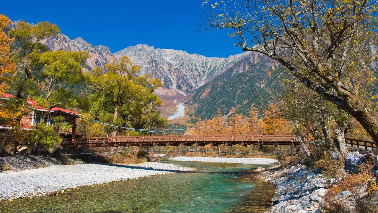
Table of Contents
Introduction
Nestled in the heart of the Northern Alps, Kamikochi is one of Japan’s premier mountain scenic destinations, where the majestic ridgelines of the Hotaka Mountain Range and the cobalt-blue waters of the Azusa River create a breathtaking tapestry. In the crisp air at an elevation of 1,500 m, visitors are enveloped by a silence untouched by car engines, surrounded by the dynamic terrain carved by glaciers and volcanoes. In 2026, the completion of trail and bridge renovations, along with improved bus terminal facilities, makes this season more comfortable than ever for enjoying Kamikochi’s magnificent nature.
In this article, we provide an overview of Kamikochi’s evolution from its origins as the sacred domain of “Kamikouchi” (meaning “within God’s fence”) to a sustainable resort, while carefully selecting the must-visit classic spots. Whether you are a first-time visitor or a captivated returning traveler, let this guide serve as your compass to fully experience the “moments where the Alps come alive.”
- Overview of Kamikochi
- History of Kamikochi
- From Sacred Mountain Valley to Sustainable Resort
- 1. 1823 | Banryu Shonin Opens Mt. Yari
- 2. 1896 | Walter Weston Publishes “Mountaineering and Exploration in the Japanese Alps”
- 3. 1915 | Major Eruption of Mt. Yakedake Creates Taisho Pond
- 4. 1952 | Dual Designation as National Special Place of Scenic Beauty and Special Natural Monument
- 5. 1975 | Private Vehicle Ban Begins on Kamikochi Park Road
- Recommended Spots in Kamikochi
- 1. Kappa Bridge — Kamikochi’s Most Photogenic Spot
- 2. Taisho Pond — The Mirror Reflecting “Inverted Hotaka” and Mt. Yakedake
- 3. Myojin Pond — A Sacred Water Mirror Where Hotaka Shrine’s Inner Sanctum Resides
- 4. Tashiro Pond & Tashiro Wetland — A Miniature Wetland Nurtured by Spring Water
- 5. Karasawa Cirque — A Heavenly Paradise Painted by Autumn Colors and Morgenrot
- Latest Information for 2026
- Summary
- Frequently Asked Questions
Overview of Kamikochi
“The moment you step off the bus, the Alps come alive.”

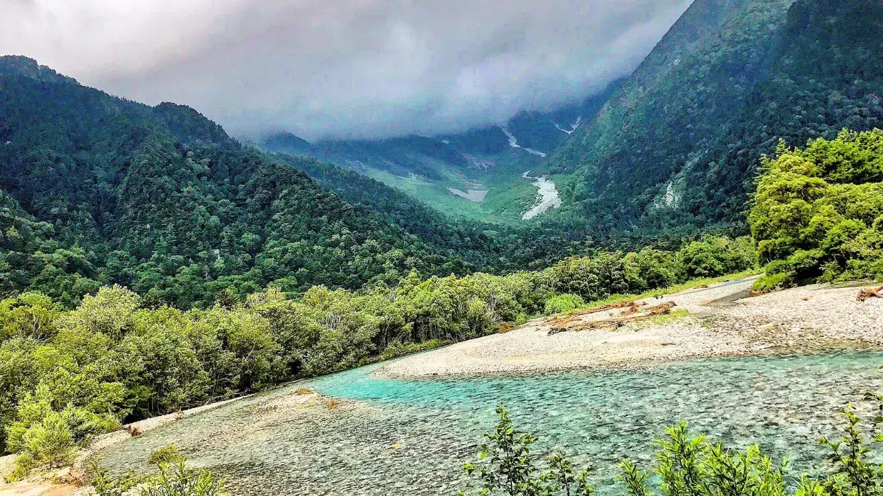
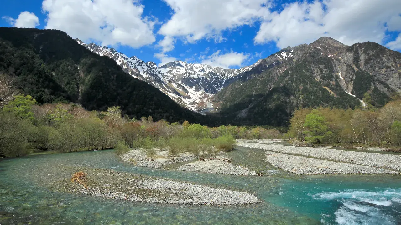
Kamikochi, where the crystal-clear Azusa River flows beneath the rugged ridgelines of the Hotaka Mountain Range, is located in Azumi, Matsumoto City, Nagano Prefecture. This highland basin at an elevation of approximately 1,500 m forms the core of Chubu Sangaku National Park. Ancient glacial terrain and volcanic wetlands intertwine in complex formations, and the grand panorama of Mt. Myojin and Mt. Yakedake seen from Kappa Bridge is renowned as one of Japan’s finest mountain landscapes. In ancient times, this area was called “Kamikouchi” (within God’s fence), a sacred domain of mountain worship, and even today the atmosphere of nature reverence remains strong, centered around Hotaka Shrine’s inner sanctum.
In 1952, Kamikochi received the rare dual designation as a national “Special Place of Scenic Beauty” and “Special Natural Monument,” which accelerated efforts to balance tourism and conservation while protecting the area from development. The year-round private vehicle ban beyond the Kama Tunnel, introduced in 1975, was a pioneering initiative aimed at reducing exhaust emissions and preserving the tranquil landscape. To this day, no vehicles other than shuttle buses and taxis are permitted entry. This strict traffic management has preserved the diverse ecosystem symbolized by Nirinso (windflower) colonies and Japanese larch forests, establishing Kamikochi as a world-renowned “Car-less Resort.”
The tourism season begins with the Mountain Opening Festival on April 27 and spans approximately seven months through the peak of autumn foliage in October until the mountain closes on November 15. During winter, road closures and facility shutdowns restrict general tourist access, and only winter mountaineers with specialized equipment can witness the snow-covered Kamikochi landscape — a distinctive seasonal division.
Access is available from both the Nagano Prefecture side and the Gifu Prefecture side. By public transportation, it takes approximately 90 minutes from JR Matsumoto Station via the Matsumoto Electric Railway and a connecting route bus. From Takayama Station, the journey takes a similar duration via Hirayu.
| Basic Data | Details |
|---|---|
| Location | Azumi, Matsumoto City, Nagano Prefecture |
| Elevation | Approx. 1,500 m |
| Terrain / Formation | Dammed lake and wetlands created by the former Azusa River glacier and Mt. Yakedake eruptions |
| Legal Designation | National Special Place of Scenic Beauty / Special Natural Monument (designated March 29, 1952) |
| Annual Visitors | Approx. 1.2 million (2023) |
| Opening / Closing | Mountain Opening Festival: April 27 / Closing: November 15 |
| Transportation | Year-round private vehicle ban / Shuttle bus and taxi from Sawando or Hirayu |
History of Kamikochi
From Sacred Mountain Valley to Sustainable Resort
Kamikochi, nestled in the folds of the Northern Alps, was originally a sacred domain called “Kamikouchi” (within God’s fence). In the late Edo period, a Shugendo monk blazed a trail to Mt. Yari, opening the area to human passage. During the Meiji era, a British missionary introduced its spectacular scenery to the world. The eruption of Mt. Yakedake in the Taisho era created Taisho Pond, an “accidental scenic wonder” that ignited a tourism boom.
Below, we highlight five landmark events in chronological order.
1. 1823 | Banryu Shonin Opens Mt. Yari
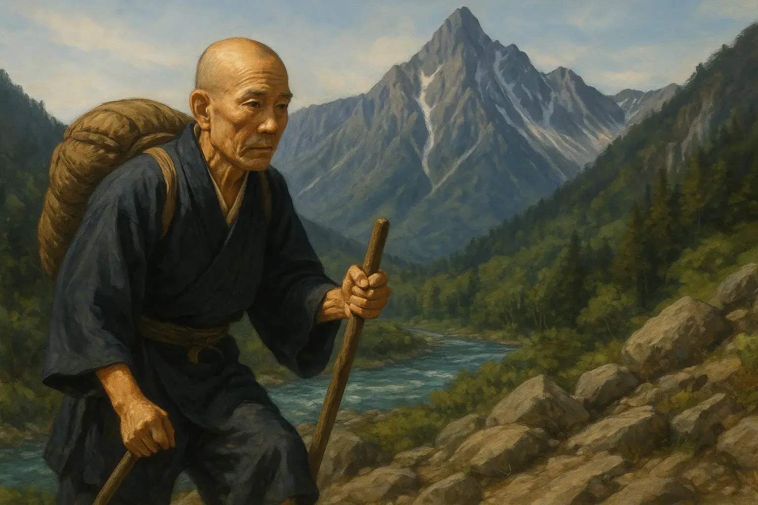
In the late Edo period, the Jodo Shinshu monk Banryu Shonin set out for Mt. Yari as part of his ascetic training, ascending along the Azusa River valley. His later writings, including “Katagadake Saiko-ki” (published in 1823), documented his mountain worship and Shugendo footsteps. The pilgrimage route he established became the prototype for the modern climbing routes connecting Kamikochi to Mt. Hotaka and Mt. Yari, marking the beginning of Kamikouchi’s transformation from a sacred pilgrimage site to the gateway of modern mountaineering.
2. 1896 | Walter Weston Publishes “Mountaineering and Exploration in the Japanese Alps”
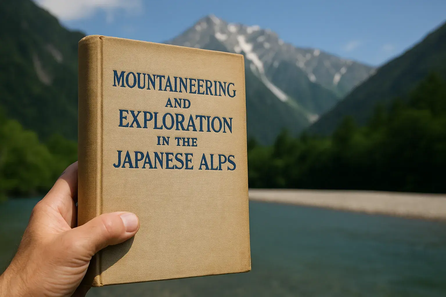
In 1896 (Meiji 29), British missionary Walter Weston published “Mountaineering and Exploration in the Japanese Alps” in London. He praised the magnificent views of Mt. Hotaka and Mt. Yari seen from Kamikochi, introducing the concept of “climbing for pleasure” to Japan. This single book made the name “Kamikochi” an aspiration for European alpinists, igniting the modern mountaineering and tourism boom.
3. 1915 | Major Eruption of Mt. Yakedake Creates Taisho Pond
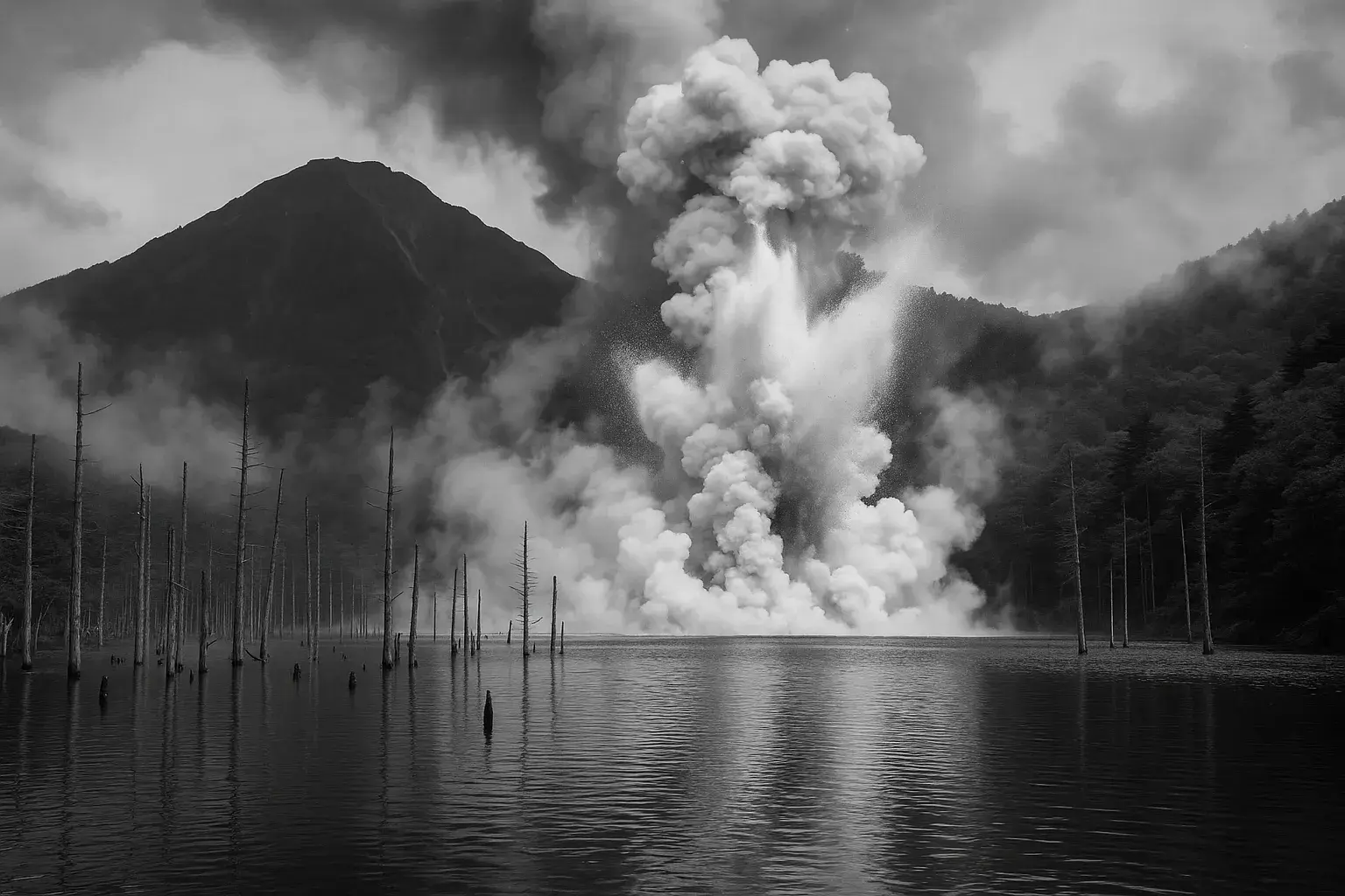
On June 6, 1915 (Taisho 4), Mt. Yakedake experienced a moderate phreatic eruption, and the resulting debris and mudflow dammed the Azusa River, creating Taisho Pond. The ethereal landscape of standing dead trees rising from the lake surface quickly became renowned, attracting photographers and literary figures. To this day, it remains Kamikochi’s most iconic scenic spot, drawing countless visitors.
4. 1952 | Dual Designation as National Special Place of Scenic Beauty and Special Natural Monument

On March 29, 1952 (Showa 27), under the Law for the Protection of Cultural Properties, the Kamikochi area (approximately 113 km2) was designated as both a Special Place of Scenic Beauty and a Special Natural Monument. Such dual designation is extremely rare in Japan, officially recognizing the value of its rare alpine plant communities, glacial terrain, and the scenic grandeur of the Hotaka Mountain Range. This designation heightened conservation awareness and laid the groundwork for future traffic regulations and facility improvements.
5. 1975 | Private Vehicle Ban Begins on Kamikochi Park Road

As exhaust fumes and traffic congestion worsened during the rapid economic growth period, in April 1975 (Showa 50), private vehicles were banned during summer. The restrictions were gradually strengthened and expanded to a year-round ban from 1996. This pioneering initiative spread to other mountain tourism areas across Japan, including Oze and Mt. Fuji, and Kamikochi has been re-evaluated as a trailblazer of “sustainable tourism.”
Recommended Spots in Kamikochi
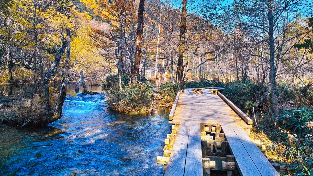
The walking trails radiating from Kappa Bridge connect both the right and left banks with nearly flat forest paths, and must-see scenery is concentrated within a 2-3 km radius in each direction. In particular, Kappa Bridge, Taisho Pond, Myojin Pond, and Tashiro Pond are the four essential spots that every first-time visitor to Kamikochi should experience.
1. Kappa Bridge — Kamikochi’s Most Photogenic Spot
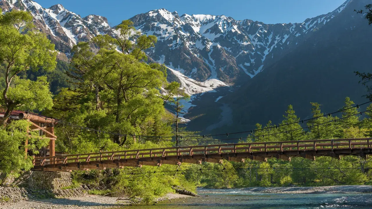
This 36 m suspension bridge spans the Azusa River. From the bridge, a grand panorama unfolds with the Hotaka Mountain Range and Dakesawa Valley directly ahead, and the active volcano Mt. Yakedake behind. Just after the Mountain Opening Festival (April 27) and during the autumn foliage season (early to mid-October), it is so crowded that the area is called “Kamikochi Ginza,” but before 6 AM, the bridge is nearly empty and visitors can encounter the mystical sight of morning mist rising from the clear stream.
2. Taisho Pond — The Mirror Reflecting “Inverted Hotaka” and Mt. Yakedake

This pond was created when the Azusa River was dammed by a phreatic eruption of Mt. Yakedake in 1915. Standing dead trees rise from the water’s surface, and on windless mornings, the Hotaka Mountain Range is perfectly reflected. After rain, mist rises and a pale blue light spreads across the water, and at night the pond becomes a prime stargazing spot. With a bus stop right at the pond’s edge (zero-minute walk), the beginner course of starting with the scenery here and then walking toward Kappa Bridge is popular.
| Indicator | Data |
|---|---|
| To Kappa Bridge | Approx. 3 km / 75 min on foot (right bank course) |
| Best Time | Early morning 5-7 AM / Clear and windless |
| Good to Know | Standing dead trees are washing away year by year, so see this ethereal landscape “while you still can” |
3. Myojin Pond — A Sacred Water Mirror Where Hotaka Shrine’s Inner Sanctum Resides
About 3.5 km along the right bank course from Kappa Bridge, at the foot of Mt. Myojin, the inner sanctum of Hotaka Shrine and two ponds appear. Once called “Kagami-ike” (Mirror Pond) for its extraordinary clarity, the water’s surface mystically reflects the surrounding forests and rocky ridges. Every year on October 8, the “Myojin Pond Boat Festival” features a traditional Japanese boat circling the pond, carrying forward the ancient mountain worship traditions to the present day.
| Indicator | Data |
|---|---|
| From Kappa Bridge | Approx. 3.5 km / 70 min on foot |
| Festival | Myojin Pond Boat Festival (October 8) |
| For Tranquility | Early morning or late afternoon (times when group tours are fewer) |
4. Tashiro Pond & Tashiro Wetland — A Miniature Wetland Nurtured by Spring Water
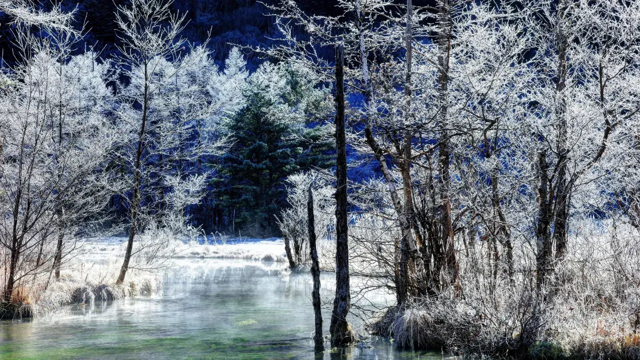
Located roughly midway between Taisho Pond and Kappa Bridge, this shallow pond nestles quietly where the forest opens up. Thanks to underground spring water, it never freezes over completely even in winter. In summer, Japanese azaleas and cotton grass can be observed, while in autumn, frost-covered wetland scenery awaits. Boardwalks are maintained, with some sections accessible by wheelchair. The pond is gradually shrinking year by year due to sediment inflow, and conservation efforts continue.
5. Karasawa Cirque — A Heavenly Paradise Painted by Autumn Colors and Morgenrot

Karasawa Cirque is a glacially carved valley formation situated at an elevation of approximately 2,300 m. Reached via a 6-8 hour one-way hiking trail from Kamikochi, this location boasts the magnificent scenery of the Hotaka Mountain Range and autumn foliage so beautiful it has earned the title of “Japan’s finest autumn colors.” In particular, the “Morgenrot” phenomenon, where the mountainside glows red at sunrise, captivates countless hikers.
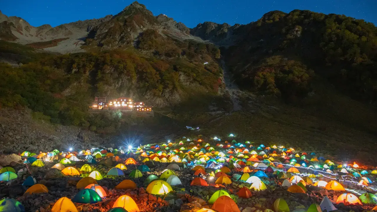
Karasawa Cirque features mountain huts such as Karasawa Hutte and Karasawa Koya, along with a well-maintained tent site. During the autumn foliage season (late September to early October), many hikers visit, and the spectacular sight of colorful tents dotting the landscape is truly breathtaking. While the hiking trails are well-maintained, the significant elevation gain and distance require adequate equipment and careful planning.
| Indicator | Data |
|---|---|
| Distance from Kamikochi | Approx. 16 km (one way) |
| Duration | Approx. 6-8 hours (one way) |
| Accommodation | Karasawa Hutte, Karasawa Koya, tent site |
| Best Season | Autumn foliage: late Sep – early Oct / Morgenrot: year-round (clear weather) |
| Precautions | Altitude sickness prevention, cold weather gear, and climbing registration required |
Latest Information for 2026
Kamikochi is scheduled to open in mid-April 2026 as usual (for reference: in 2025, the road opened on April 17 and the Mountain Opening Festival was held on April 27). The private vehicle ban is enforced year-round; access is via shuttle bus or taxi from Sawando or Akandana parking areas. Shuttle buses do not require reservations (first-come, first-served), with one-way fares of approximately 1,500 yen.
The open season runs until the Mountain Closing Festival on November 15. Please check the official Kamikochi website for the latest road opening dates and bus timetables.
Summary
Kamikochi is a truly special place where the valley beauty sculpted by glaciers and volcanoes over tens of thousands of years coexists with the pristine nature that our predecessors have worked to protect. Now that the 2026 improvements have made it more accessible than ever, why not come to the banks of the Azusa River, where the ridgeline of the Hotaka Range is reflected, and experience a profound serenity far from everyday life? Let us observe proper manners and rules, and pass this miraculous landscape on to future generations.