🕓 2026/2/14
#Sightseeing
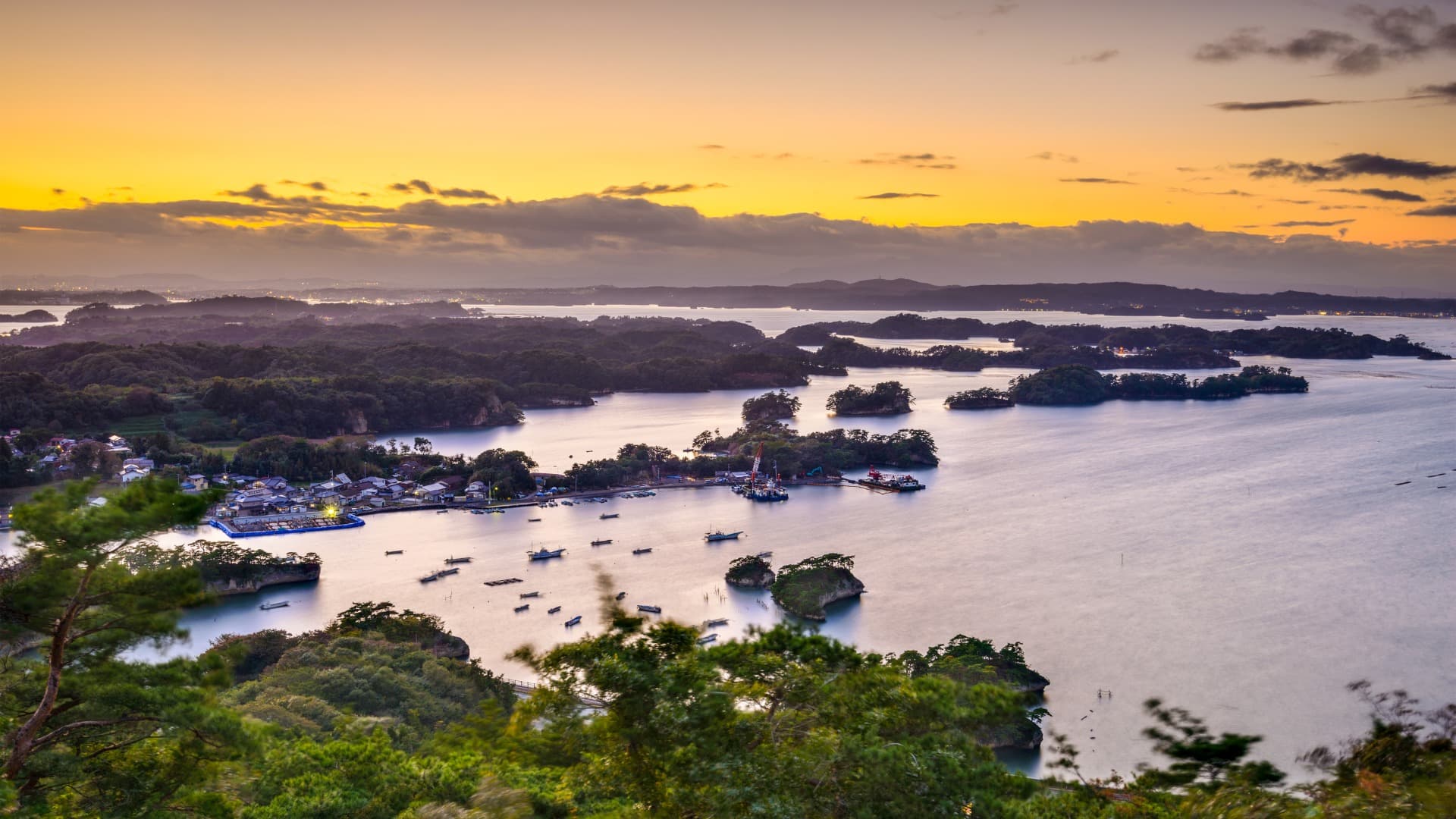
Table of Contents
- Sendai Castle Ruins (Aoba Castle) | A Spectacular View Built by Date Masamune
- Zao Okama | The Mystical Emerald Green Crater Lake
- Matsushima | A Breathtaking View Among Japan’s Three Most Scenic Spots!
- 3 Must-Visit Tourist Spots in Miyagi Prefecture
- — What is Miyagi Prefecture? —
- Sendai Castle Ruins (Aoba Castle) | A Spectacular View Built by Date Masamune
3 Must-Visit Tourist Spots in Miyagi Prefecture
— What is Miyagi Prefecture? —
Miyagi Prefecture is located in the Tohoku region of Japan, with Sendai as its capital city. This area has been deeply intertwined with Japanese history since ancient times, and is home to rich natural beauty alongside diverse cultures and traditions.
Historically, Miyagi Prefecture was part of a region once known as “Mutsu Province.” In particular, the area around present-day Sendai was developed as a castle town by Date Masamune and became known as the stronghold of the Date clan.
In 2011, the Great East Japan Earthquake caused tremendous damage to the area. This disaster was a major trial for Miyagi Prefecture, and the road to recovery was long and challenging. However, through the process, community bonds strengthened, and with support from across the nation, the region has continued its steady march toward recovery.
Sendai Castle Ruins (Aoba Castle) | A Spectacular View Built by Date Masamune


● The Appeal of Sendai Castle Ruins
Sendai Castle Ruins (Aoba Castle) is located in Aoba-ku, Sendai City, Miyagi Prefecture. It is the site of the castle built in 1601 (Keicho 6) by Date Masamune, the first lord of the Sendai Domain. Constructed atop Mount Aoba at an elevation of approximately 130 meters, the castle was known as a natural fortress, protected by steep cliffs to the east and south. While the castle buildings no longer remain, the stone walls and reconstructed turret evoke the grandeur of its past.
At the honmaru (main enclosure) site stands an equestrian statue of Date Masamune, and the location is popular as a scenic viewpoint offering panoramic views of Sendai City and the Pacific Ocean. At night, the stone walls and the equestrian statue are illuminated, creating a fantastical atmosphere. The Aoba Castle Museum on the grounds allows visitors to learn about the history of Sendai Castle through exhibits and restored video footage.
The entire castle ruins area has been developed as Aobayama Park, a spot where visitors can enjoy historical walks amid the beauty of nature throughout the four seasons.
● History of Sendai Castle Ruins
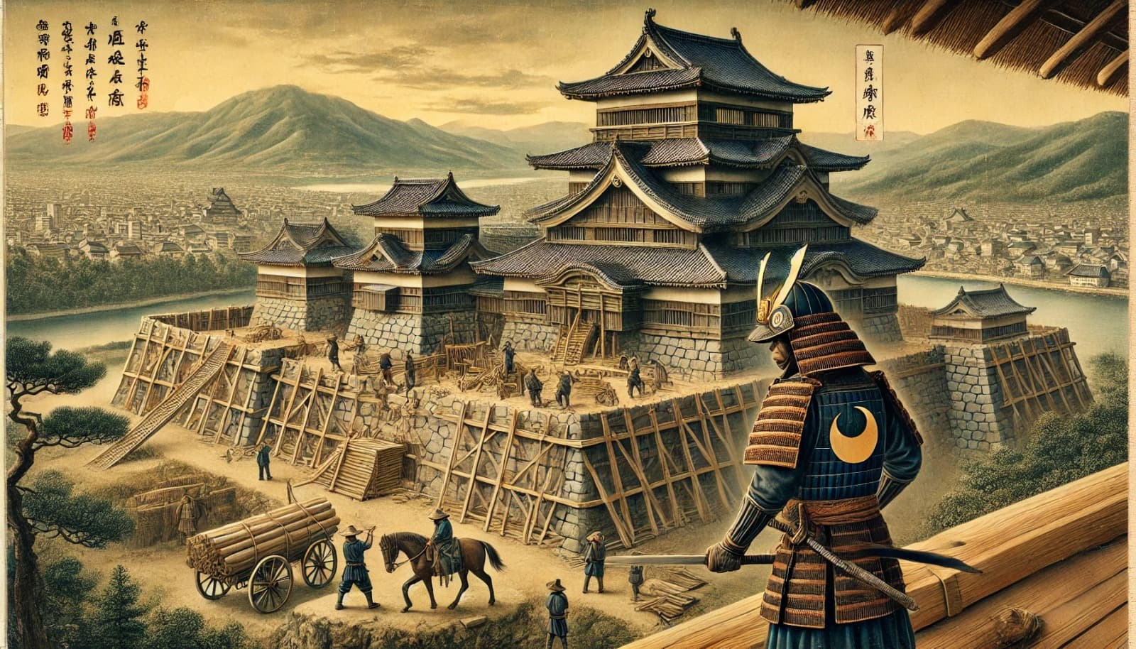
Sendai Castle was built by Date Masamune, the first lord of the Sendai Domain. The castle layout was planned in December 1600, immediately after the Battle of Sekigahara, and full-scale construction began in January of the following year. The honmaru was designed as a mountain castle that utilized the natural terrain — the east side facing the Hirose River cliffs, the south bordered by the Tatsu-no-kuchi Gorge, and the west surrounded by a forest known as “Oura-bayashi.”
After Masamune’s death, the second lord, Date Tadamune, ordered the construction of the ninomaru (secondary enclosure) at the foot of the mountain, which was completed in 1639. From that point on, the ninomaru served as the center of domain governance, and Sendai Castle functioned as the Date clan’s residence for approximately 270 years. However, following the Meiji Restoration and the abolition of domains, the castle came under government control. In 1871, military facilities were established in the ninomaru, but a fire in 1882 destroyed many of the remaining structures.
● Access to Sendai Castle Ruins
- Address: Kawauchi, Aoba-ku, Sendai, Miyagi
- Google Maps Link: Sendai Castle Ruins (Aoba Castle)
- Walking Access: Take a bus from Sendai Station, get off at “Sendai City Museum Mae,” then walk about 5 minutes
- Train/Bus: About 20 minutes on foot from “Kotodai-koen Station” on the Sendai City Subway Namboku Line, or bus available


● The Appeal of Zao Okama
Zao Okama is a volcanic crater lake located on the border of Miyagi and Yamagata Prefectures within the Zao mountain range, renowned for its mystical beauty. Surrounded by three peaks — Zao Karita-dake, Kumano-dake, and Goshiki-dake — this circular lake derives its name “Okama” (cauldron) from its distinctive shape. The lake surface holds emerald green water that contrasts with the rugged crater walls, creating an atmosphere of profound mystery. Because the color of the lake changes with the angle of sunlight and weather conditions, it is also known as “Goshiki-ko” (Five-Colored Lake).
Due to the lake water’s strong acidity, no organisms can survive in it. Additionally, the water temperature drops to 2 degrees Celsius at a depth of about 10 meters from the surface, but rises again at greater depths — a rare dual-layer water structure found in very few lakes worldwide. Zao Okama, where visitors can enjoy scenic beauty throughout the four seasons, is a spectacular spot beloved by many tourists for its awe-inspiring natural mystique.
● History of Zao Okama
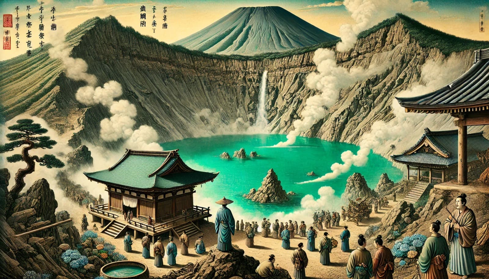
The history of Zao Okama dates back approximately 1,000 years to volcanic activity. The current crater lake was formed by an eruption around the 10th century, and has undergone several subsequent eruptions and tectonic movements to reach its present form. During the Edo period, Okama was known as “Goshiki-numa” (Five-Colored Pond) and was passed down among locals and travelers as a mystical place. Additionally, Mount Zao as a whole was regarded as an object of worship, serving as a site for mountain worship (sangaku shinko) and ascetic training (shugendo).
In the modern era, Zao Okama began attracting attention as a tourist destination, and in 1925, Mount Zao was designated as a national park, drawing many visitors.
● Access to Zao Okama
- Address: Togatta Onsen, Zao-machi, Katta-gun, Miyagi
- Google Maps Link: Zao Okama
- By Car: Approximately 50 minutes from “Yamagata Zao IC” on the Yamagata Expressway
- Public Transportation: Take a bus from Yamagata Station via “Zao Echo Line” to the “Zao Okama” bus stop
Matsushima | A Breathtaking View Among Japan’s Three Most Scenic Spots!


● The Appeal of Matsushima
Matsushima, located in Miyagi Prefecture, is one of Japan’s Three Most Scenic Views and a breathtaking destination. Approximately 260 small islands dot Matsushima Bay, and the landscape created by these pine-covered islands captivates all who visit. The views from the “Four Great Viewpoints” (Shidaikan) are particularly outstanding, each named “Sokan” (grand view), “Reikan” (beautiful view), “Ikan” (magnificent view), and “Yukan” (serene view).
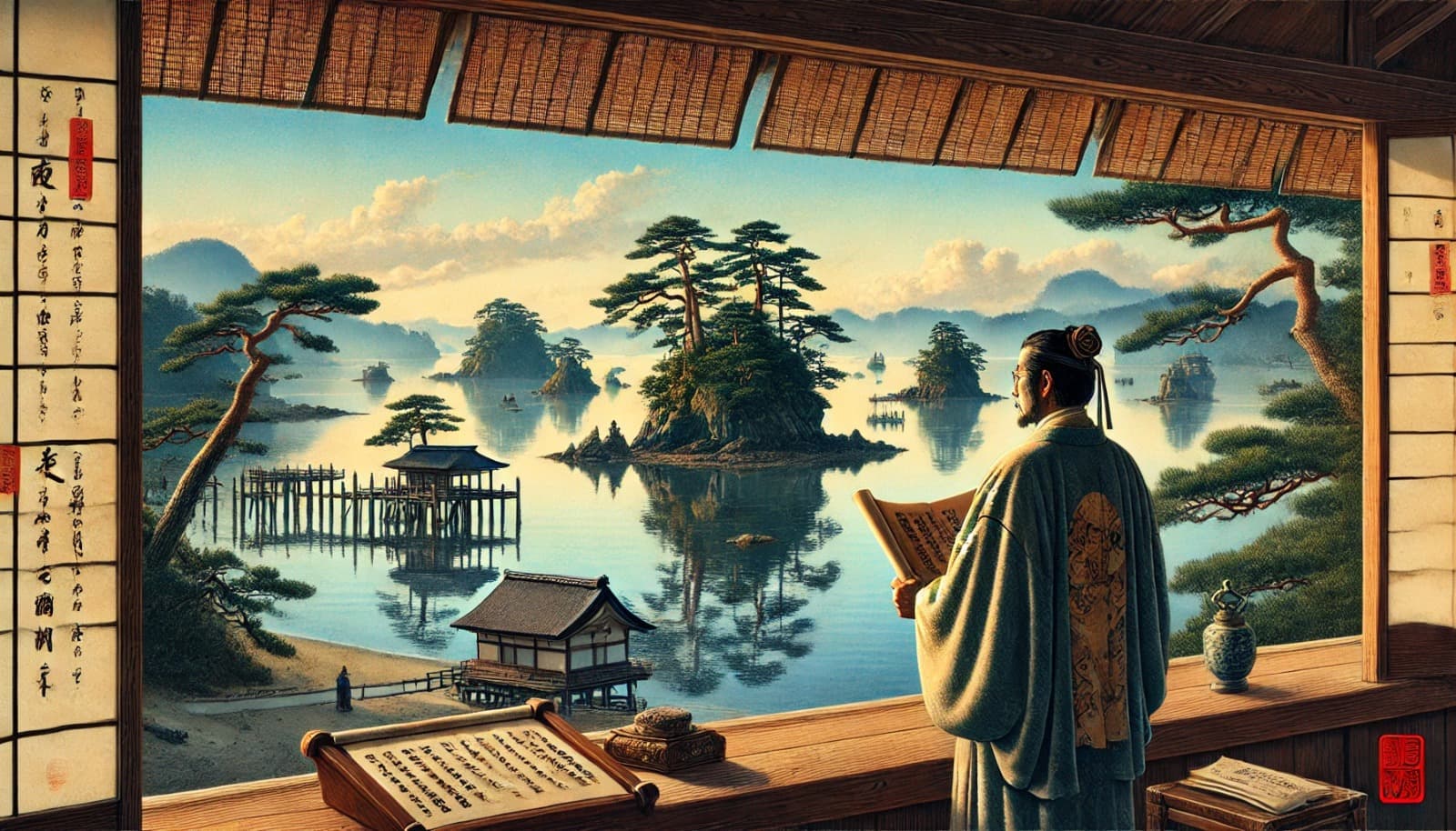
Known as one of Japan’s Three Most Scenic Views, Matsushima has enchanted many literary figures and travelers since ancient times. The haiku poet Matsuo Basho was so overwhelmed by its beauty that he was reportedly left speechless. The area is also dotted with notable landmarks connected to Date Masamune, including Zuigan-ji Temple and Godaido Hall.
Sightseeing cruises around Matsushima Bay allow visitors to enjoy the beautiful island scenery from the sea, and the ever-changing views across different seasons and times of day add to the enduring appeal of Matsushima.
● History of Matsushima
The topography of Matsushima is believed to have formed into its current multi-island seascape through tectonic activity and rising sea levels following the Ice Age, approximately 20,000 to 30,000 years ago. This unique terrain was shaped by nature over an immense span of time.
Date Masamune, the first lord of the Sendai Domain, built temples such as Zuigan-ji and Godaido in Matsushima, developing the area as a center of regional culture and faith. During the Edo period, the haiku poet Matsuo Basho visited Matsushima and was reportedly amazed by its beauty. His travelogue “Oku no Hosomichi” (The Narrow Road to the Deep North) describes the scenery of Matsushima.
There are various theories about the origin of the name “Matsushima.” One theory suggests that Prince Shotoku waited for the arrival of the Indian monk Bodhidharma, and “Matsu-shima” (waiting island) became “Matsushima.” Another theory suggests that Emperor Toba gifted 1,000 pine saplings to the monk Kenbutsu Shonin during his ascetic training, and the area became known as “Senmatsu-jima” (Thousand Pines Island), later shortened to “Matsushima.” However, the most widely accepted theory is simply that the islands were named “Matsushima” (Pine Islands) because of the many pine trees growing on them.
● Access to Matsushima
- Train: 15-minute walk from Matsushima Kaigan Station on the JR Senseki Line (to Fukuura Bridge); 10 minutes by taxi from Sakamoto Station on the JR Joban Line (to Karabune Bansho ruins).
- By Car: Approximately 50 minutes from Sendai City.
- Google Maps Link: Matsushima
■ Related Articles