🕓 2024/2/11
#Tourist Destinations
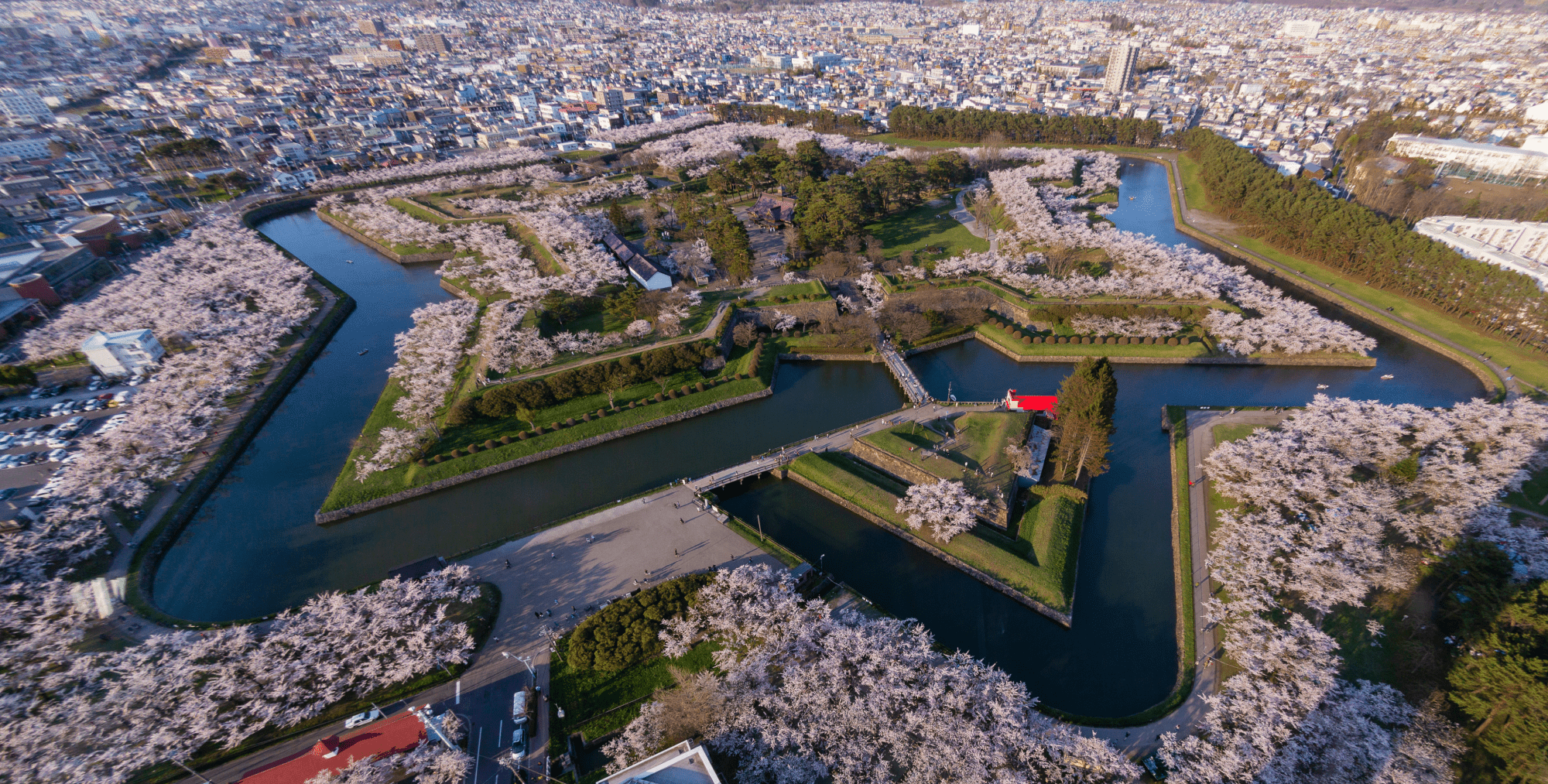
Table of Contents
- A Land Where Majestic Nature Thrives | World Heritage Site: Shiretoko Peninsula
- A Canal Town Illuminated by Gas Lamps | Otaru
- History Engraved in a Star-Shaped Fortress | Goryokaku
- Top 3 Must-Visit Tourist Spots in Hokkaido
- — What is Hokkaido?Hokkaido is a vast region located at the northernmost tip of Japan, covering a total area of approximately 83,423 square kilometers, which accounts for about 20% of Japan’s total land area. Across this expansive land, untouched nature stretches far and wide, and the beautiful scenery that changes with each season captivates all who visit.
- Attractions of Shiretoko Peninsula
- The Shiretoko Peninsula is a long, narrow peninsula located at the far northeastern tip of Hokkaido, stretching approximately 70 km in length with a base width of about 25 km. In July 2005, it was registered as a UNESCO World Natural Heritage Site, with its pristine nature and rich ecosystem receiving high acclaim. At the center of the peninsula, a chain of volcanoes including Mt. Rausu (elevation 1,661 m) forms the magnificent Shiretoko Mountain Range.
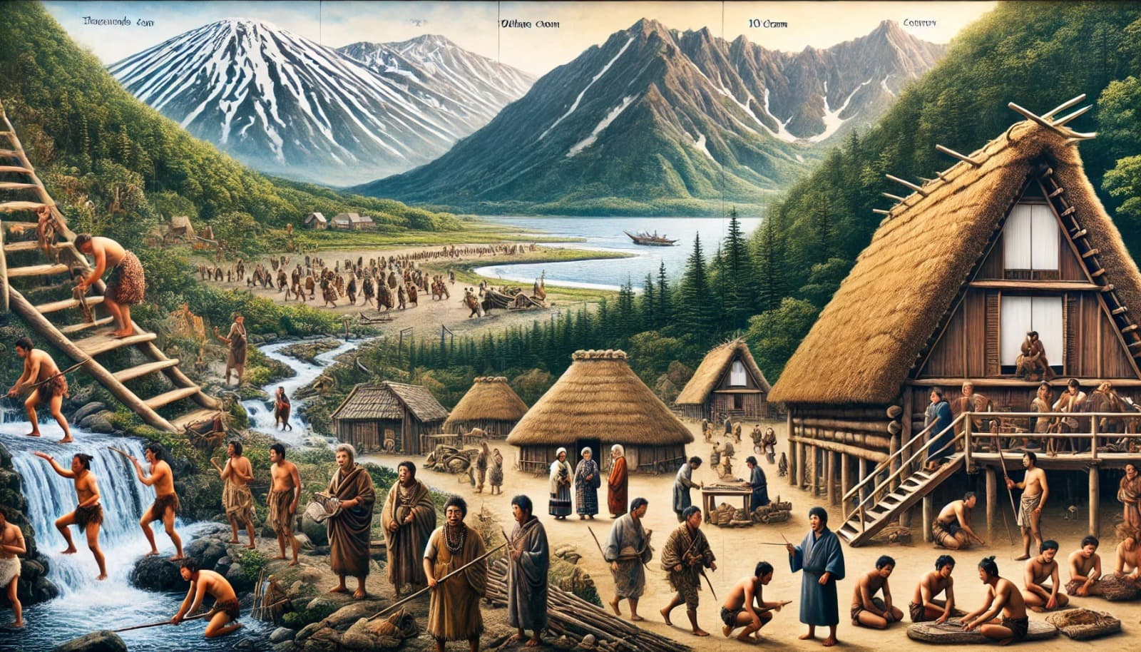
- History The history of the Shiretoko Peninsula dates back thousands of years to prehistoric times. Around the 10th century, the area came under the influence of the Okhotsk culture, and eventually the Ainu people settled in this land, building a unique culture that coexisted with nature.
- Address: 099-4356 Onbetsu-mura, Shari-cho, Shari-gun, Hokkaido
- Attractions of Otaru
- The Otaru Canal is an iconic tourist attraction of Otaru City, Hokkaido, captivating many visitors with its historic scenery and romantic atmosphere. Along the approximately 1,140-meter-long canal, former stone warehouses line the banks, now renovated into cafes, restaurants, and shops, offering visitors a variety of enjoyments.
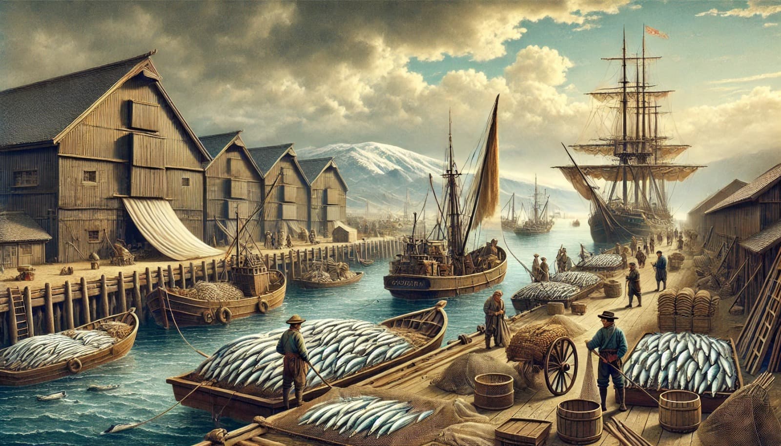
- The history of Otaru City dates back to the time when the Ainu people, the indigenous inhabitants, conducted trade in this area. The place name “Otaru” derives from the Ainu word “Ota-or-nai” (a river running through a sandy beach). Particularly from the 1850s onward, Otaru rapidly developed as a commercial city due to the prosperity of herring fishing, earning the nickname “Herring Gold Rush.”
- Address: Otaru City, Hokkaido
- Goryokaku is known for its unique star-shaped design and is considered a symbol of spring in Hakodate. In spring, Goryokaku Park is adorned with approximately 1,500 cherry trees, captivating visitors with its beauty. From Goryokaku Tower, you can not only enjoy a panoramic view of this distinctively shaped fortress but also take in the impressive scenery of Hakodate city and the Tsugaru Strait.
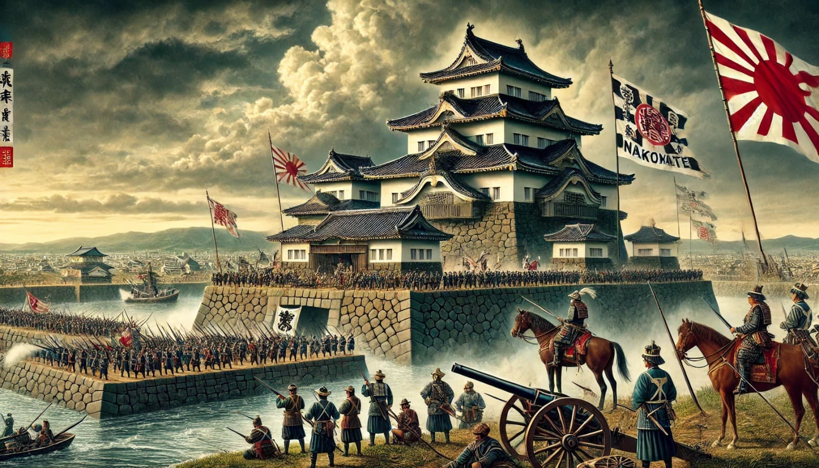
- Goryokaku was built at the end of the Edo period to defend against foreign invasion. However, it was actually used during the Boshin War, a Japanese civil war. In 1868 (the first year of Meiji), the former shogunate army led by Enomoto Takeaki landed in Ezo (Hokkaido) with approximately 3,000 soldiers and occupied Goryokaku. This was a movement aimed at establishing a separate government distinct from the new Meiji government.
- Address: Goryokaku-cho, Hakodate City, Hokkaido
Top 3 Must-Visit Tourist Spots in Hokkaido
— What is Hokkaido?Hokkaido is a vast region located at the northernmost tip of Japan, covering a total area of approximately 83,423 square kilometers, which accounts for about 20% of Japan’s total land area. Across this expansive land, untouched nature stretches far and wide, and the beautiful scenery that changes with each season captivates all who visit.
Beyond its rich natural environment, Hokkaido is also known as a treasure trove of cuisine, offering fresh seafood and agricultural products. Additionally, the hot spring resorts scattered throughout the region offer a variety of water qualities, providing visitors with relaxing and rejuvenating experiences.
Furthermore, Hokkaido possesses unique charms in each season — cherry blossoms in spring, lavender fields in summer, autumn foliage in fall, and snow-covered landscapes in winter — offering new impressions of beauty with every visit.
A Land Where Majestic Nature Thrives | World Heritage Site: Shiretoko Peninsula
Attractions of Shiretoko Peninsula


The Shiretoko Peninsula is a long, narrow peninsula located at the far northeastern tip of Hokkaido, stretching approximately 70 km in length with a base width of about 25 km. In July 2005, it was registered as a UNESCO World Natural Heritage Site, with its pristine nature and rich ecosystem receiving high acclaim. At the center of the peninsula, a chain of volcanoes including Mt. Rausu (elevation 1,661 m) forms the magnificent Shiretoko Mountain Range.
Shiretoko is one of the lowest-latitude regions in the world where seawater freezes, and during winter, drift ice covers the sea. The abundant nutrients brought by this drift ice promote the growth of plankton, forming the foundation of a rich food chain. As a result, a diverse range of wildlife inhabits this area, including brown bears, Ezo deer, Steller’s sea eagles, and seals.
In addition, many mystical natural landscapes exist here, such as the Shiretoko Five Lakes and Kamuiwakka Hot Falls, offering visitors beautiful scenery that changes with the seasons. The Shiretoko Peninsula can truly be called a miraculous land where majestic nature thrives.
History of Shiretoko Peninsula
History The history of the Shiretoko Peninsula dates back thousands of years to prehistoric times. Around the 10th century, the area came under the influence of the Okhotsk culture, and eventually the Ainu people settled in this land, building a unique culture that coexisted with nature.
However, due to the harsh natural environment, agricultural development proved difficult, and the importance of nature conservation gradually increased. In 1964, the area was designated as Shiretoko National Park, and in 1977, the “Shiretoko 100 Square Meter Movement” began, advancing efforts to protect nature from reckless development.
As a result, it was registered as a UNESCO World Natural Heritage Site in 2005. The decisive factors for registration were its unique environment where a rich marine ecosystem nurtured by drift ice coexists with primeval forests, as well as its status as a habitat for rare wildlife.
Access to Shiretoko Peninsula
Address: 099-4356 Onbetsu-mura, Shari-cho, Shari-gun, Hokkaido
- Google Maps:
- Public Transportation:https://maps.app.goo.gl/QtmzZxAbggchT1aw6
- From Kushiro Airport, you can take the JR Senmo Main Line to Shiretoko-Shari Station, and bus transfers are also available. During winter, limited-period buses for drift ice sightseeing are also in operation. While public transportation and rental cars are common means of getting around, schedules may change depending on the season and weather conditions, so advance confirmation is recommended.>> Click here for details on Shiretoko National Park


The Otaru Canal is an iconic tourist attraction of Otaru City, Hokkaido, captivating many visitors with its historic scenery and romantic atmosphere. Along the approximately 1,140-meter-long canal, former stone warehouses line the banks, now renovated into cafes, restaurants, and shops, offering visitors a variety of enjoyments.
Especially from dusk to nighttime, the 63 gas lamps installed along the canal promenade are lit up alongside the stone warehouses, creating a scene that has been designated as a Japan Night View Heritage site and is beloved by many.
The approximately 40-minute “Otaru Canal Cruise” is also a popular activity. During the day cruise, you can enjoy a guide’s commentary on Otaru’s history and notable sites, while the night cruise lets you savor the romantic nightscape illuminated by gas lamps from the water. Especially in winter, the combination of the snow-covered canal and gas lamps creates a beauty reminiscent of a painting, captivating visitors.
History of Otaru
The history of Otaru City dates back to the time when the Ainu people, the indigenous inhabitants, conducted trade in this area. The place name “Otaru” derives from the Ainu word “Ota-or-nai” (a river running through a sandy beach). Particularly from the 1850s onward, Otaru rapidly developed as a commercial city due to the prosperity of herring fishing, earning the nickname “Herring Gold Rush.”
In the Meiji era, the first railway in Hokkaido — the government-operated Horonai Railway — opened between Temiya (Otaru) and Sapporo in 1880, establishing the city’s status as a logistics hub. The development of Otaru Port also advanced, playing an important role as a coal shipping port.
Along with this economic prosperity, financial institutions and trading companies gathered here, developing the city to the point where it was called the “Wall Street of the North.” However, from the early Showa period onward, due to the decline of herring fishing and the shift of the economic center to Sapporo, Otaru’s economy gradually stagnated.
Access to Otaru
Address: Otaru City, Hokkaido
- Google Maps:
- Train: From Sapporo to Otaru, you can use the JR Hakodate Main Line “Rapid Airport” express or local trains.https://maps.app.goo.gl/N5ZWVnjb7Sq53Xnm7
- >> Click here for details on Otaru
History Engraved in a Star-Shaped Fortress | Goryokaku


Goryokaku is known for its unique star-shaped design and is considered a symbol of spring in Hakodate. In spring, Goryokaku Park is adorned with approximately 1,500 cherry trees, captivating visitors with its beauty. From Goryokaku Tower, you can not only enjoy a panoramic view of this distinctively shaped fortress but also take in the impressive scenery of Hakodate city and the Tsugaru Strait.
This site is also significant as a stage of the Boshin War, and through the exhibits and information boards on the grounds, visitors can reflect on Japan’s modern history.
Cultural facilities such as the Hakodate Magistrate’s Office and the Hokkaido Hakodate Museum of Art are scattered around the area, allowing visitors to engage with history and culture. Furthermore, Hakodate’s delicious seafood cuisine is another pleasure when visiting Goryokaku. Goryokaku is a charming tourist destination where you can simultaneously experience its historical background, natural beauty, and regional culture.
History of Goryokaku
Goryokaku was built at the end of the Edo period to defend against foreign invasion. However, it was actually used during the Boshin War, a Japanese civil war. In 1868 (the first year of Meiji), the former shogunate army led by Enomoto Takeaki landed in Ezo (Hokkaido) with approximately 3,000 soldiers and occupied Goryokaku. This was a movement aimed at establishing a separate government distinct from the new Meiji government.
However, due to the overwhelming offensive by the new government forces, Goryokaku was gradually cornered, and many members of the former shogunate army, including Hijikata Toshizo, lost their lives here. This battle is known as the final battle of the Boshin War and became the last stand of the shogunate.
Access to Goryokaku
Address: Goryokaku-cho, Hakodate City, Hokkaido
- Access: From JR Hakodate Station, take the streetcar bound for Yunokawa, get off at “Goryokaku-Koen-Mae” stop, and walk approximately 15 minutes.
- Official Website:
- Goryokaku Tower Official WebsiteGoogle Maps:
- >> Click here for details on Goryokakuhttps://maps.app.goo.gl/jFGvMH6QjPCbpiXPA
– Top 3 Recommended Gourmet Foods in Hokkaido